
Lower Puyallup River Floodplain Mapping Project

Floodplains & Flood Risk

Learn how floodplains, flood maps, and flood risk are used to support safer communities.

Lower Puyallup History

Discover how the river, floodplain, and flood protection systems have changed over time.

Project Status Updates

Discover how the river, floodplain, and flood protection systems have changed over time.
About the Project

The Lower Puyallup River valley has long been protected by a system of levees however, in 2004, FEMA identified that many of these levees did not meet federal accreditation standards. At the time, limitations in mapping methods prevented the full extent of flood risk behind non-accredited levees from being shown on FEMA’s regulatory flood maps.


Since then, new studies indicate that estimated flood flows are substantially greater than those used in previous FEMA mapping, making portions of the current Flood Insurance Rate Maps (FIRMs) severely outdated.

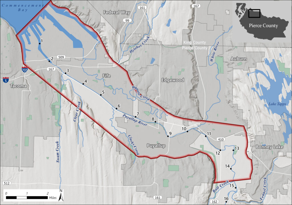
This project will evaluate flood hazards along approximately 15 miles of the Lower Puyallup River, from the Ball Creek confluence near River Mile 14.7 downstream to Commencement Bay. The project area, shown on the map to the right, is outlined in red. Using current engineering methods and FEMA standards, the project will develop updated flood hazard information that can support future revisions to FEMA flood maps and provide communities with a more accurate understanding of flood risk.

As the project progresses, this website will be updated with information on draft mapping products and opportunities for public involvement. Check back regularly to follow project progress and learn how updated flood maps may affect your community.